Why has this website been set up?
Charnwood Borough Council and Loughborough University have created this website to give people the opportunity to share their ideas and thoughts about streets, public spaces and buildings. Whether you are a local resident, councillor, visitor, community group or local business we would encourage you to get involved.
Your comments about streets, public spaces and buildings throughout Loughborough Town Centre and across Charnwood will help us to better understand what people like, do not like and how they think new developments could be designed better in the future.
We will use this information to help create a new Design Code for new developments across Charnwood.
The comments and observations we are looking for are those that that the Borough Council can address through planning policies and decisions. The basis for planning policies and decisions are set out in the National Planning Policy Framework, National Design Guide and the National Model Design Code.
If you have concerns about street cleansing (such as litter, waste or recycling services/collection or dog fouling), please visit this link for further assistance: Street cleansing
For issues relating to anti-social behaviour please visit this link for further information: Anti-social behaviour
Please be aware that this website is not designed for the reporting of issues such as those related to street cleansing or anti-social behaviour. We regret that the Borough Council cannot address such issues via this website.
Please note that the Borough Council will not be acknowledging or replying to individual comments or observations made on this website. The Borough Council will produce a report that analyses the comments and observations made, setting out how (and if) the council intends to embed comments or observations into a Design Code. This report will be published and made available on the Borough Council’s website later this year.
What is a Design Code?
All local planning authorities in England are required by the government’s National Planning Policy Framework to set clear design policies for their local areas. These design policies will then be used to help planning authorities decide whether planning applications should be approved.
The government is currently encouraging local planning authorities to express these design policies through Design Codes.
A Design Code is a document that contains design rules for new developments. Rules can cover the design of streets, public spaces and buildings. Spaces can be either public (such as parks) or private (such as back gardens).
A Design Code is a bit like the Highway Code. The Highway Code is a set of rules that many people will be familiar with. It sets out clear rules for road users and explains what, where and when rules apply. The Highway Code is clear, short and easy to understand, with images and words explaining what the rules are.
We expect the Code to cover a range of issues including:
- Street design, walking and cycling.
- Cycle and car parking.
- Public spaces, trees, water and nature.
- Layout and building design.
- Local character.
Who is involved in creating the Design Code?
Charnwood Borough Council is working alongside Loughborough University to deliver this project.
This project has secured funding from Loughborough University’s Impact Hub. The Impact Hub is currently supporting five research projects that will support the development of a new data observatory for Loughborough. The data observatory will be launched in early 2026 and will gather and share important data about Loughborough, providing interactive insights about the town and its communities.
The Impact Hub is part of a £2.46million government-funded initiative that aims to create jobs, support new businesses and enhance community health and wellbeing.
How can I contribute?

Tag.
Find the place you want to make a comment on using our interactive map. Zoom into the street, public space or building you want to make a comment or observation about, click Tag + and follow the simple instructions on screen.

Type.
Share your thoughts about where you’ve dropped a tag by typing a few words. We are keen to understand what you like, what you do not like and what you think could be designed better.

Snap.
You can choose to upload a photo directly from your smartphone or computer (optional).
You can see and agree with the tags and comments other people have made on the interactive map. Other people will also be able to see any tags and comments you make.
All tags and comments will be uploaded to the Colouring Britain website at the end of the project by Loughborough University (no personal data relating to participants, such as names, email address or postcode will be shared).
Note for iPhone users:
- Navigate to Settings > Privacy > Location Services.
- Please ensure the Location Services option is toggled on.
- Scroll down and look for Safari.
- Select the app and choose one option from a list of Never, Ask Next Time, While Using the App, and Always.
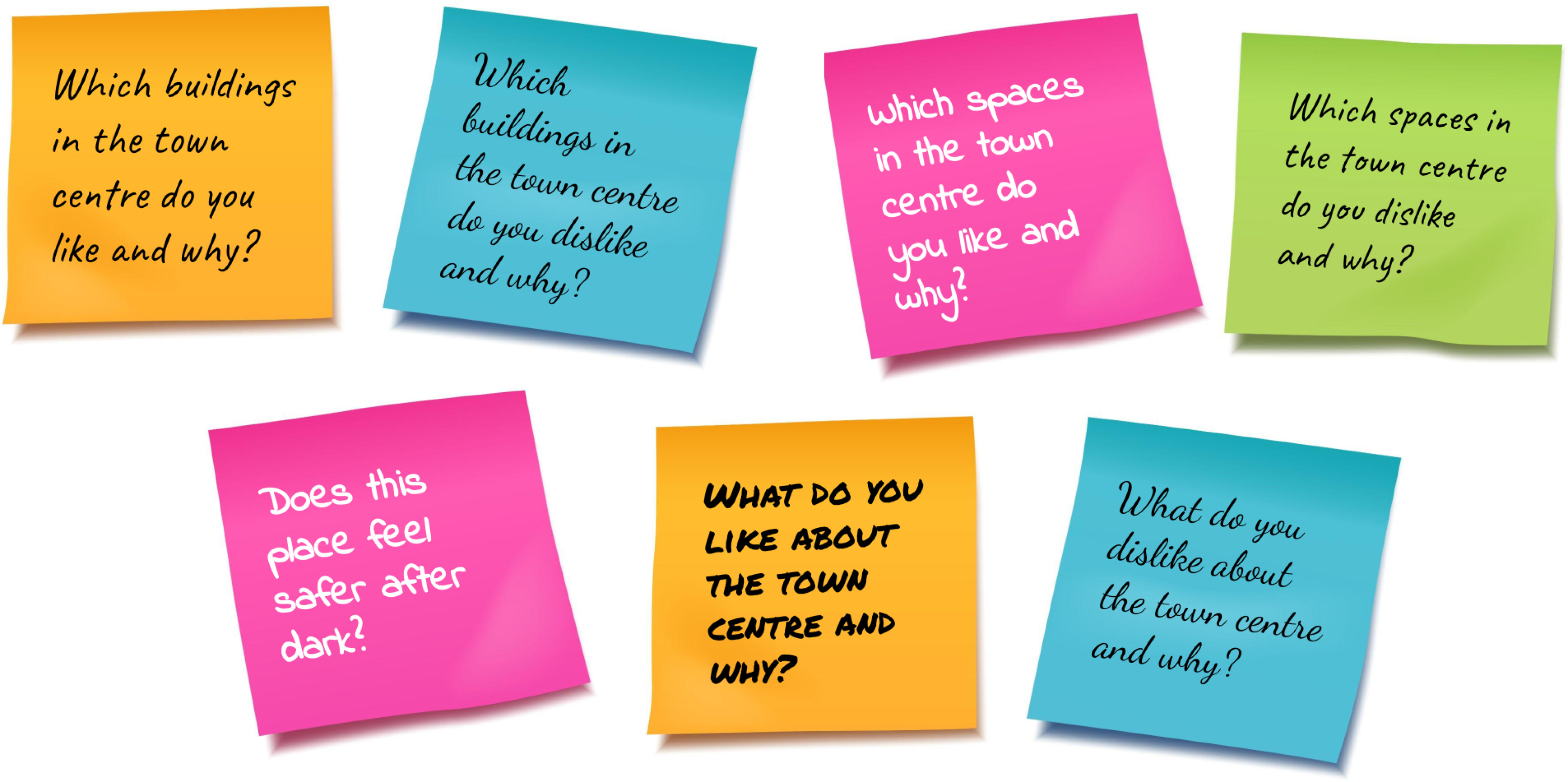
What do we want to know about Loughborough town centre?
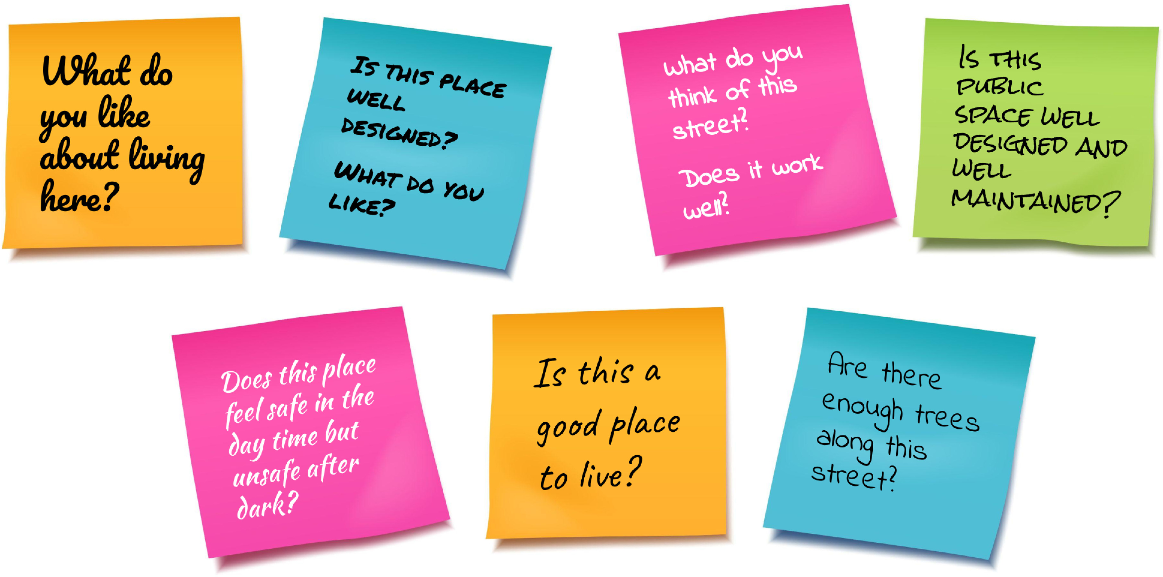
What do we want to know about the suburbs?
When will we see the Design Code?
The first stage of the project is to understand what people think about streets, public spaces and buildings.
A draft Design Code is expected to be published in 2026.